Korea Weekend Forecast: Freezing Mornings, 15°C Swings, Rough Seas Near Ports
A photo from the morning of the 11th shows canola blooms in Eongdeungmul Valley in Saekdal-dong, Seogwipo, Jeju Island. The new weekend weather outlook for South Korea calls for clouds across most regions on Saturday, with chilly mornings and milder afternoons and a notable temperature swing of as much as 15 degrees Celsius.
Inland areas could see morning temperatures drop to 0°C or below, with frost possible in parts of Chungcheong inland and the southern inland regions. Daytime highs are forecast to range from about 10°C to 15°C depending on location. Across major cities, the forecasted highs are roughly 12°C in Seoul, Suwon and Ulsan; 10°C in Incheon; 13°C in Gangneung, Sejong, Busan and Jeju; 14°C in Daejeon; and 15°C in Gwangju and Daegu.
On Sunday the 15th, mornings are again expected to dip below freezing, with daytime highs between 10°C and 15°C. Temperatures are projected to stay close to seasonal norms in the coming days, with the usual cool nights and mild daytime warmth.
Looking at regional weather, the 14th is expected to be mostly cloudy in the central regions, with the southern regions seeing periods of cloudiness. Jeju Island is forecast to be generally clear. In the inland, fog may reduce visibility to under 1 kilometer in places during the morning, especially near rivers, lakes and valleys.
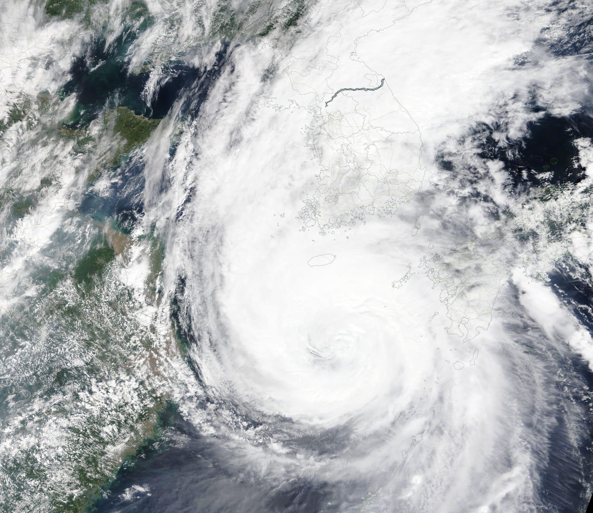
Sea conditions will be noteworthy for mariners. Winds of 30 to 60 kilometers per hour are forecast over the southern East Sea, the eastern part of the South Sea, and the southeastern inner waters near Jeju Island, with strong swells along the East Coast and Jeju coastal areas. Mariners and coastal facilities may need to monitor conditions for any disruption or safety considerations.
![Poster for the prèmiere of Claude Debussy and Maurice Maeterlinck's Pelléas et Mélisande at the Théâtre de l'Opéra-Comique on 30 April 1902. Phototype by Berthaud at 31, Rue Bellefond, Paris. 0.860 x 0.620 m.[1]](https://journalkor.site/content/images/2026/03/02_Georges_Rochegrosse_-_Poster_for_the_pr_miere_of_Claude_Debussy_and_Maurice_Maeterlinck_s_Pell_as_et_M_lisande-3.jpg)
Air quality is expected to be favorable, with fine dust levels rated as good to moderate across the country.
Why this matters to U.S. readers: South Korea is a major hub for electronics manufacturing and global supply chains, including semiconductors and consumer devices. Strong winds and swells can affect shipping traffic through key ports like Busan and Ulsan, potentially influencing schedules for goods moving to North America and Europe. Frost in inland areas may impact agricultural production and energy demand, while chilly mornings and variable daily temperatures can shape travel plans and business operations in the region. Finally, Jeju’s tourism economy could be affected by shoulder-season weather, influencing travel and hospitality markets that include U.S. travelers and tour operators with Korea-linked itineraries.